Map Analysis Blog Project
Wednesday, February 12, 2014
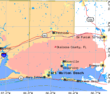
Okaloosa County
https://www.google.com/search?q=map+of+okaloosa+county&espv=210&es_sm=122&tbm=isch&imgil=mQ7kCuNAbE_zCM%253A%253Bhttps%253A%252F%252Fencrypted-tbn0.gstatic.com%252Fimages%253Fq%253Dtbn%253AANd9GcQhNEzENF9znS800RNcrItZwfNEmCUuBot16gMKevcRvLRB6U7FQg%253B422%253B359%253BrPLm_Y8SPrb6qM%253Bhttp%25253A%25252F%25252Fwww.city-data.com%25252Fcounty%25252FOkaloosa_County-FL.html&source=iu&usg=__Jt9SnVzmCtJoS8llBa6a0TIFzRI%3D&sa=X&ei=eNP7UpLmEMnOkQfYyYHIDQ&ved=0CDEQ9QEwAQ&biw=1680&bih=925#facrc=_&imgrc=mQ7kCuNAbE_zCM%253A%3BrPLm_Y8SPrb6qM%3Bhttp%253A%252F%252Fpics4.city-data.com%252Ftym%252Fun362.png%3Bhttp%253A%252F%252Fwww.city-data.com%252Fcounty%252FOkaloosa_County-FL.html%3B422%3B359
This map represents Okaloosa county. I reside here so I thought this would be appropriate to put in my map project. It displays major roads and cities in the county. This map can be classified as a cartogrphical animations map.
No comments:
Post a Comment
Newer Post
Home
Subscribe to:
Post Comments (Atom)
No comments:
Post a Comment