Wednesday, February 19, 2014

Schools in Great Britian


http://static.persquaremile.com/wp-content/uploads/2011/11/school-establishments-in-great-britain-before-1860.png

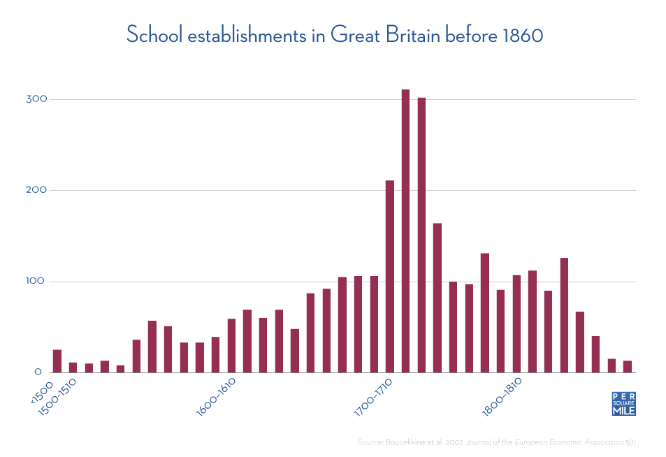
This is a Statistical map of school establishments in Great Britain between 1500 and 1810. Its represents how many schools per square mile the country had.

Population Density of the U.S.

http://www.mapofusa.net/us-population-map.gif

This is a maps showing population densities for the United States. This map is a Thematic map.

Point Washington

http://sowal.com/sites/default/files/point-washington-state-forest-map.gif

This is a map of Point Washington State forest located in Florida. This map shows bodies of water, roads, and man made structures such as restrooms and parking lots. This is a planimetric map as well as a cadastral map.

Florida State Talahassee

http://www.cge.fsu.edu/theglobe/directions.cfm

This is a map of the Tallahassee campus of Florida State. This map displays man made features and does not contain elevation. This is a planimetric map.